
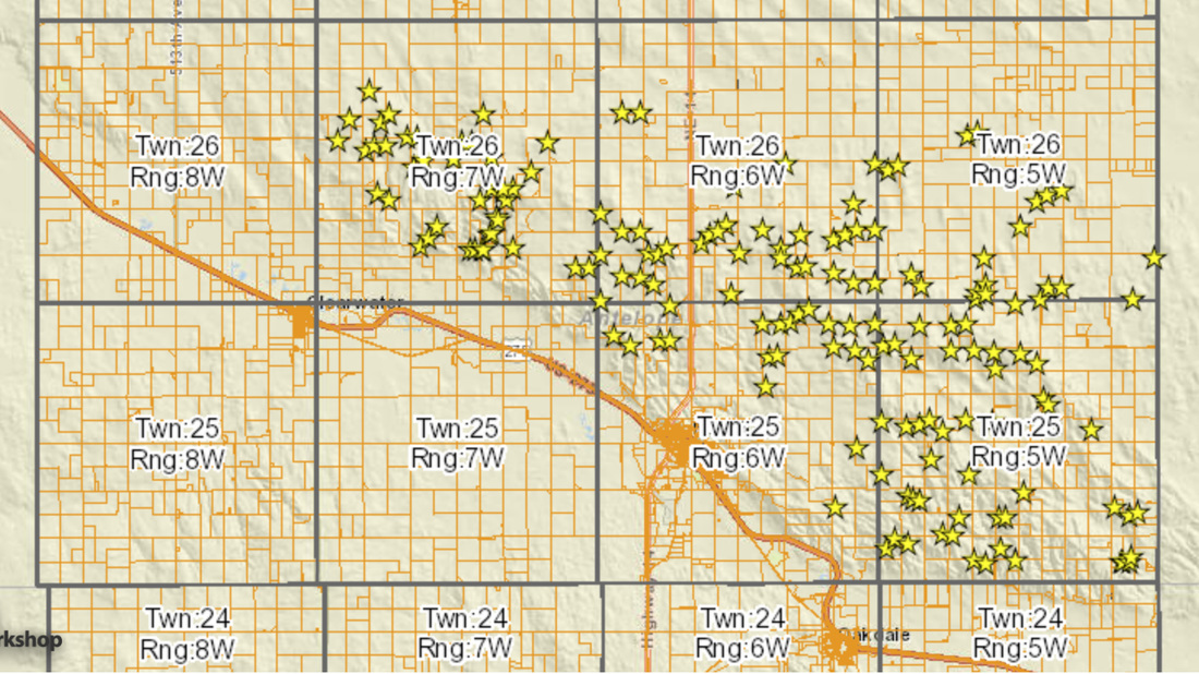
  Where are the wind towers going to be located? Are there going to be any towers near my house? These are just a few of the questions that have been asked about the conditional use permit application for Invenergy Wind Development on behalf of Upstream LLC to construct 168 wind towers.
The answers to many of these questions are now available on the Antelope Assessor GIS website, http://antelope.gisworkshop.com. Antelope County Assessor Kelly Mueller announced the new GIS map layer during a recent Antelope County Supervisors’ meeting. “We have had a lot of requests for a map that would clearly show the location of the proposed wind towers. Tax payers can now see where the towers will be located on a satellite imagery of the county,” she said. “Towers are represented by a yellow star on the map. Users will be able to see their home structures, property lines, land features, and the tower locations all at one time. The site is very user friendly.” The website allows searches by parcel identification number, current owner, and legal description. A help section is available to offer assistance in navigating the website. A copy of the aerial map will be displayed at the Neligh American Legion on May 24th during the public hearing. |
|

 RSS Feed
News That Matters To Antelope County - Your News. Your Way. Every Day!

|

|

|
© Pitzer Digital, LLC